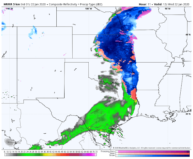
A change from rainfall to a winter mix/snowfall should take place late tonight across regions of central Kansas. As this wave of moisture marches east, it will begin to transform as it interacts with subfreezing air. This should likely take hold as a persistent snowfall, as the mid levels of the atmosphere will support that.
 |
| Simulated Radar (early Wednesday AM) |
 |
| Snowfall/winter mix continues east |
By mid-morning, temperatures will slowly begin to climb across much of the region. This will cause snowfall to mix with sleet - eventually turning to a cold rain with surface temperatures still freezing (freezing rain). By the lunch hour, most of the frozen precipitation will have stopped across much of the south central U.S (aside from some high elevation regions).
There is always uncertainty when a winter weather event is approaching. Sleet mixing with snow will always reduce snowfall totals. How quick will the rainfall cut into the winter mix? Will temperatures really maintain the freezing mark? These can all have HUGE impacts on the forecast.
As I'm typing this blog, I've already been made aware of some school closings across the local area. This is a tough call for schools, but I wouldn't be surprised if numerous rural districts close their doors tomorrow. It's very risky to run the morning school commute in conditions we could experience tomorrow morning.
Thanks for reading, and remember to follow me and the Vortex Crew on Twitter. I'll link those accounts below as we update there often!
-Zach


