

- Tomorrow will be warm and VERY humid. Excessive heat warnings have been issued for some counties locally. We should remain mostly dry throughout the day.
- Thunderstorms should form tomorrow to our northwest into Kansas and Missouri. These storms will form along a front and move southeast toward Arkansas.
- I fully expect these storms to be fairly strong as they move into northwest Arkansas, where a rather unstable atmosphere will exist.
- All modes of severe weather will be possible, but I suspect damaging wind gusts and larger hail to be the main concern.

The Storm Prediction Center has issued an enhanced risk across much of Missouri and into northeast Oklahoma. A slight risk has also been issued to encompass this risk area. I wouldn't be the least bit surprised if the slight risk area is extended south to include more of western Arkansas.
By tomorrow evening, storms should be formed and well on their way southeast. Storms could be well matured by the time they arrive into northwest Arkansas.

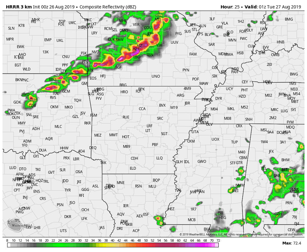
Fast forward and storms have entered northwest Arkansas, the complex stretching well across Missouri and even eastern Oklahoma. Mind you, this is simulated radar imagery and shouldn't be taken literally. Although, it does present a solid idea on what we could expect.

The last model I'd like to share is the CAPE, or convective available potential energy output. This represents what I like to term as "thunderstorm fuel". Warm humid air will aid in destabilizing our atmosphere tomorrow. This will allow for sustained thunderstorm development and track as storms enter NW Arkansas tomorrow. Notice those values within the purple and gray, anything over 2,500 j k/g is more than enough for strong to severe thunderstorm activity.
Be sure to follow Dan, Melissa and Rick on KNWA and on social media. This blog is a basic detail regarding this event. I'll be out chasing storms tomorrow evening with plenty of updates on Facebook and Twitter. Follow me on Twitter! (@wxzachary).
-Zach


