
This aspect is always frightening for weather forecasters, as most will be sound asleep during severe weather. Assure that you have a proper way to receive warnings Wednesday night, a NOAA weather radio is a great start.
- Southerly surface flow will continue to advect warm air north into Arkansas Wednesday. This warm moist air will set the stage by destabilizing our atmosphere. Temperatures will remain warm until a strong cold front sweeps the state on Thursday.
- It appears most of the expected severe thunderstorm activity should occur within the late afternoon into the evening hours of Wednesday. This could extend into the early morning hours of Thursday.
- We will elaborate more below, but west central and northwest Arkansas seems to have the highest chances for severe weather.
- All modes of severe weather will be possible, including damaging winds, larger hail and an isolated tornado or two. Heavy rainfall could also cause flash flooding issues late Wednesday night.
- By mid-day Thursday, eastern and southwest Arkansas could still see some rainfall associated with this system. However, the severe threat will be diminished.
We have several model graphics below. Simply click on them to enlarge if some of the text is difficult to read.
 |
| Slight Risk Area |
A "slight" risk area has been issued by the Storm Prediction Center for portions of NWA, west central Arkansas and some of north central Arkansas. A marginal risk area is also in place for areas surrounding the slight risk. Just because you don't live in the slight risk area does not mean you won't see storm activity. This is simply the area highlighted with the best chances for severe thunderstorm development.
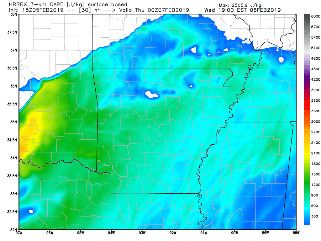
Let's take a look at some CAPE. If you've read our blogs before, you've likely seen us mention "CAPE". CAPE, is the shortened term for convective available potential energy. In other words, a measurement of the present instability. Amounts here are not very high, although it does not take much CAPE during the winter months to produce stronger thunderstorms. Notice the higher amounts across eastern Oklahoma.

By Wednesday afternoon, we could begin to see an uptick in storm activity. Some of these storms could initialize and remain isolated for some time. This COULD heighten the tornado threat, just something to watch for now.

By Wednesday evening, thunderstorms are still on-going. Some of these storms could also be severe. Notice some of the storm activity is still isolated.

By late Wednesday, into the early morning hours of Thursday, storm mode should switch to more linear. This will likely result in the all too familiar "squall" line type thunderstorm complex. Tornado threat will be limited, with more of a damaging wind threat along the gust front. This complex should weaken as it tracks east.
If you have any questions, feel free to comment or message. Thank you so much for reading and remember to share.
-AW


