
Here is what you can expect!
- Valentines Day looks soggy to start, with showers moving through in the early morning hours and continuing into the late morning. Nothing severe is expected with these showers.
- The showers that do move through will not be anything frozen, temperatures should remain in the 40's containing this to just a cold rain.
- Temperatures during mid-day will be mild, ranging from the high 40's to low 60's. Nothing record breaking, but a bit warmer than what we've been experiencing . Temperatures will warm up even more on Thursday.
- Some winter weather does look possible in the Thursday/Friday time frame. It's still too early to say how much of an impact it will cause, if any at all.
Below we have posted several models showing rain chances, temperatures, and winter weather chances:

Showers will begin to move into the state Tuesday evening and will continue into the early morning hours of Wednesday (Valentines Day) as shown in the model above (NAM 3km). Some of these showers could be heavy at times.

The showers will continue throughout the night and remain into the late morning hours. Notice the showers moving east, and eventually pushing out to the east. Some isolated areas of light rain could exist behind the heavier showers.

Overall, rainfall totals don't appear too impressive with southeast and portions of eastern Arkansas seeing the highest amounts.

Temperatures will vary across the state, cloud cover could prohibit increase in temps for certain areas. You can likely expect low 50's and 60's for most of the state.
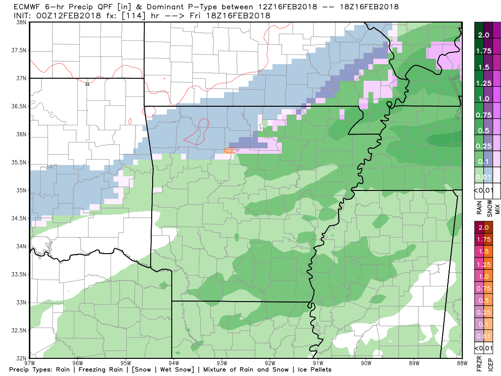
Now, the moment you've all been waiting for - snow chances! Remember, this is still preliminary, so snow lovers don't get too excited. Temperatures will be much warmer Thursday, then a strong cold front will progress south causing temperatures to nose dive. As the front moves south some wrap around frozen precipitation is possible. This is not a big snow event, so don't get too excited. However, it does look like some areas could see this winter weather as the front moves south. We've posted a model above (ECMWF) showing the wintry mix (blue, purple, pink colors) lagging behind the front causing the switch over from rain. At this time northern Arkansas has the highest chances to see the frozen precipitation, but this must be watched. We will have a much more detailed blog involving this if model trends continue in favor of winter weather.
Thanks for reading and once again, have a great Valentines Day!
-AW Team
All models are credited to: Weatherbell.com
All models are credited to: Weatherbell.com


