
Here's what you can expect!
- Temperatures will remain fairly cool for the next couple of days, on Monday warmer air will usher in from the south as the cooler air retreats north. This could spark a few storms as the boundary moves east.
- A more potent system looks possible on Tuesday/Wednesday. With warmer moist air in place, a cold front will approach from the northwest. As the front approaches, storms could form along the front, some of these could be stronger than what we have seen.
- Behind the front much colder air will arrive, along the back side of the front some winter weather could be possible. This should be confined to northern and northwest Arkansas.
Below are models posted showing temperatures, storm chances, and winter weather possibilities:
 |
| Warmer air moving in Monday morning. |
Temperatures will remain cool for the rest of today (2-17-18), and Sunday. Throughout Monday morning warmer, moist air, will progress north from the south. This will cause temperatures to rise, and the cold air to retreat north. Some storms could be possible Monday afternoon, but overall instability appears limited and we are not expecting much.
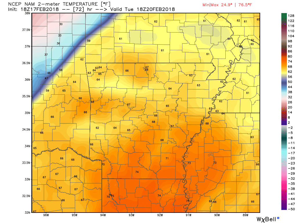 |
| Even warmer air for Tuesday, note the 70's across southwest Arkansas! |
Tuesday will be even warmer than Monday, notice the mid-70's across southwest Arkansas around noon. If you take a look in the northwest portion of the model snapshot, you can see the cold front making its way southeast. As this front progresses southeast, storms will form near the front as the colder air forces its way under the warm and moist air.
 |
| Thunderstorms forming along the cold front Tuesday evening |
In the model posted above, storms are moving southeast near the front. This model valid for approximately 9 PM Tuesday evening. Instability and lift appears to have more sustainable chances to support thunderstorm development on Tuesday rather than Monday. If you look closely, you can see the winter mix trailing closely behind the cold front.
It should be noted that not all models agree on the winter weather chances behind the front on Tuesday, this is just one model. We aren't spending much time on it either, due to it's minimal impacts and unlikelihood. We will monitor the storm chances closely, and any changes that do occur we will update accordingly.
-AW Team
All models used belong to (Weatherbell.com)
Models used (NAM 12-KM)


